
Review – GPS Navigation Apps for iPhone

I have the worst sense of direction in the world. I couldn't find my way out of a wet paper bag with a fork and a flashlight.I'm also the kind of male driver who won't stop and ask for directions.
I've used PNA's (personal navigation assistants) or PDA's/smartphones with GPS receivers and apps since about 2004, and have since graduated to both Android phones and the iPhone. On Android, Google Maps with Navigation is an awesome application, and free to boot. No one has yet come up with something to beat it.
On the iPhone 4S, though, I'm at a disadvantage. Google Maps for iOS hasn't seen any real improvement of note since July of 2008. To fix that, I took a hard look at a number of GPS apps for iPhone.
A couple of important points about GPS apps, first. First, GPS apps are totally map-dependent: outdated, inaccurate, or missing maps makes the navigation app useless. GPS apps also come in two flavors: those with maps on board (storage-based) and those that serve up maps on demand via a cellular data connection (connectivity-based). Both have their pros and cons:
- Needed Storage
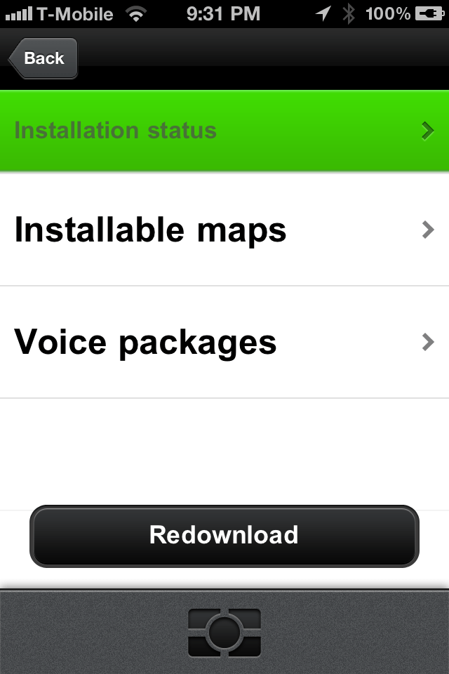
Navigation apps with maps on board use a lot of storage. Maps and their metadata (points of interest, etc) aren't small files. If you use this type of application, you may need to limit the amount of other data – photos, music, videos and apps – you keep on your iPhone. The storage-based navigation apps within this roundup consumed approximately 1.25-1.75 GB of space, each.
- Needed Connectivity
Navigation apps that download maps on an as-needed basis require a solid 3G/4G/LTE cellular data connection. Anything slower (GPRS or EDGE) won't work, as your vehicle is likely going to be moving faster than your device can download data. Please note that in well-covered, metropolitan areas this likely isn't an issue. However, I have found that when when I'm driving out in the middle of nowhere, with spotty cell coverage – is when I need the app the most.
A couple of other important points before we get started:
- After-Purchase, or In-App Purchases
Many navigation vendors have changed their revenue models. They used to rely on just the navigation app to provide revenue. Now, after your initial purchase is made, most navigation app publishers charge you a subscription fee for the maps you need, or for other services like live traffic. In-app and subscription-based purchases can range in price from $0.99 to $30.00 or more. - Map Refresh Subscriptions
Most storage-based navigation apps offer some kind of annual subscription for refreshed maps. If you find an app you like and know you’re going to use it, invest in the map subscription. Like I said, outdated or inaccurate maps make navigation apps useless. Subscriptions usually auto-renew and offer 2-4 updates a year. - Initial Data Downloads and Wi-Fi for Storage Based Navigation Apps
Many storage-based navigation apps download the entire map at time of purchase. Others allow users to purchase maps from within the app. If done on the device, the map data is obviously not transferred via sync cable. Most apps will not download map data directly on the device without a Wi-Fi connection as most map sizes range from 1-2GBs.
- WARNING Regarding Distracted Driving
There’s been a lot of information released about the NTSB’s distracted driving recommendations. While I may not agree with all of their conclusions, their point about distracted driving is accurate. If you’re driving, your attention should be on driving. If you need to configure a PNA or smartphone for navigation, please do so before you begin travelling.
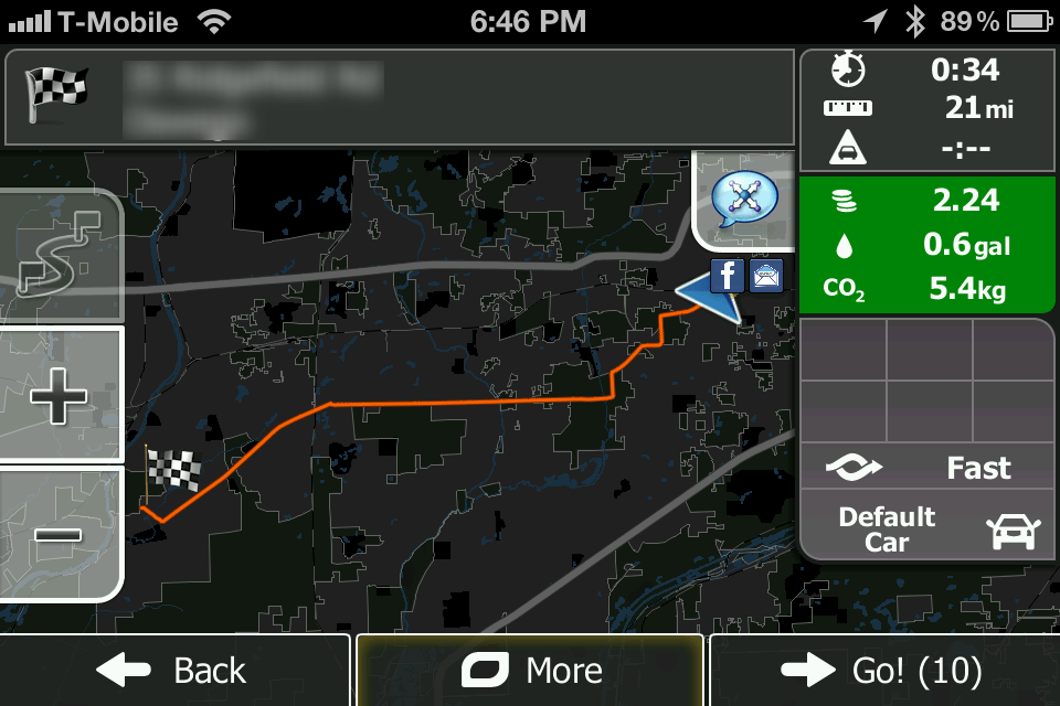
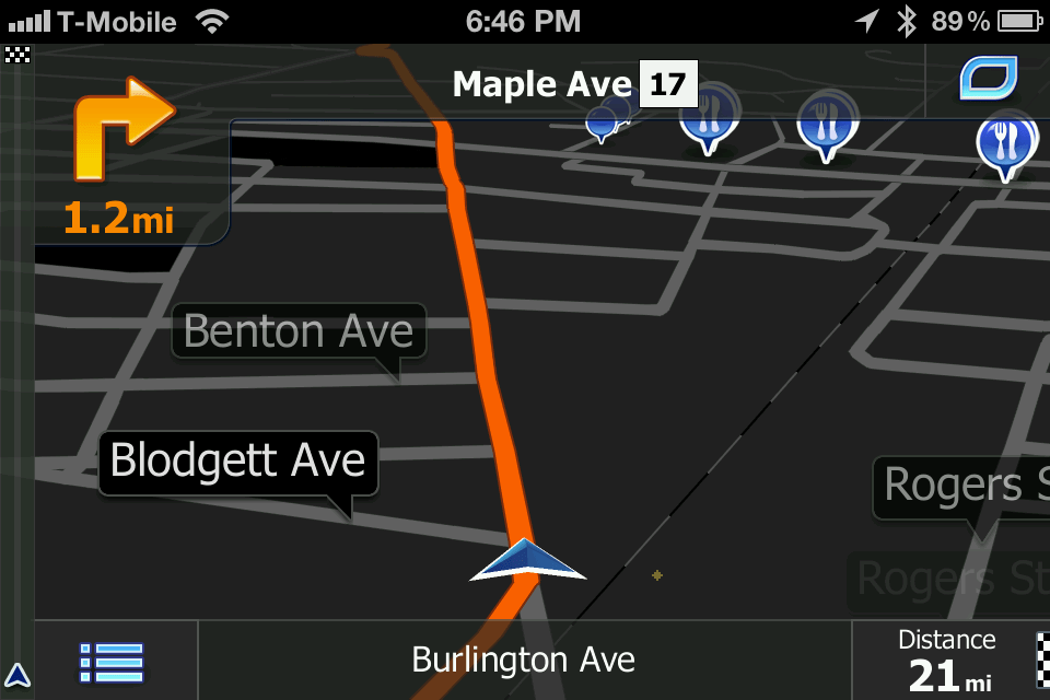
iGo primo
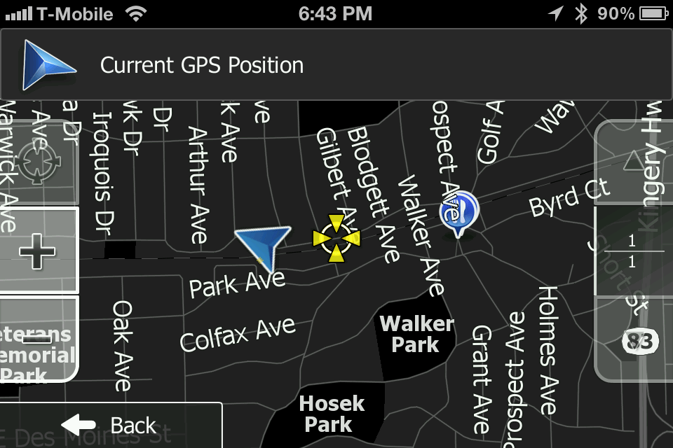
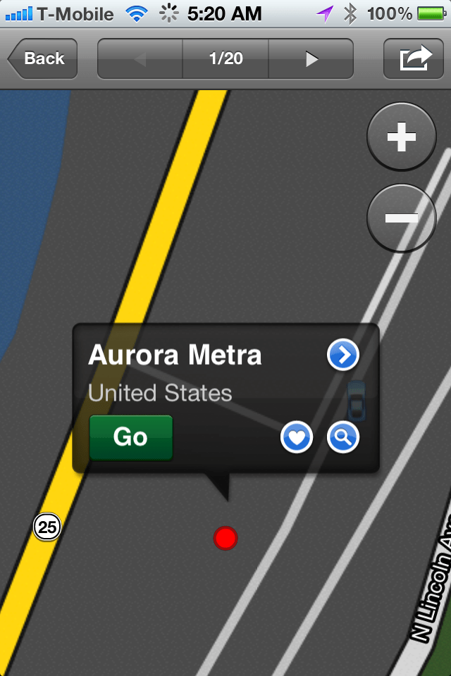
iGo primo has decent graphics and both 2D and 3D navigation displays. My iPhone 4S had no problem getting and retaining a decent GPS signal with the app, and my location on screen was generally accurate vs. my actual geographic position.
A lite or maps-only version of the application is available in the App Store for free, and gives you search capabilities for points of interest around your current location. Buy the full app and you get unlimited navigation with the map version that came with the application at time of purchase.
iGo primo’s TTS (Text-to-Speech) feature allows the app to correctly pronounce city, street and highway names as part of the guidance instructions. TTS Pro reads out not only standard voice commands, but also traffic events and a summary of the planned route and relevant country info after crossing a national border. Text-to-Speech is available in English, French, German, Italian, Spanish, Portuguese, Russian; and vary in applicable packages.
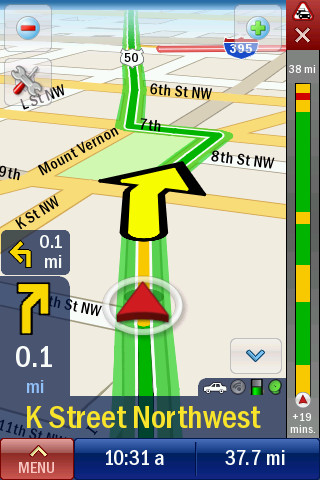
During navigation, iGo primo features Realistic Junction View, or true-to-life images of motorway junctions for easier orientation. This is a huge boon, especially if you’re making the “great American road trip” and navigating to areas you aren’t familiar with. Knowing exactly what the exit you’re supposed to take looks like can be a big deal.
One of iGo primo’s other big draws its its free live traffic feature. Live traffic shows you road congestion and traffic jam information in real time, allowing you to navigate around them, keeping your journey on time and on track. iGo primo provides automatically-generated, alternative routes based on up-to-date traffic information on your present route. You don’t have to do anything. Live Traffic Updates are available for Europe, Western Europe, Italy, France, Scandinavia, Benelux, Brazil, North America lite (mapping and searching only), North America, Russia and DACH applications.
$39.99 USD
(Storage) iTunes – North America, iTunes – Europe
 |
 |
 |
 |
 |
 |
 |
|
 |
 |
 |
 |
 |
 |
 |
TomTom for iOS
Using TomTom for iOS brought me back to my TomTom USA for PocketPC days. I wrote a couple of very in-depth reviews on both their initial entry into the US market and its subsequent (and major) upgrade. Sadly, not all of that previous content is available online. However, I was reminded of the software’s original PPC look and feel in the latest iOS version, which was somewhat comforting.
 With any storage-based navigation solution, the biggest problem you have is the freshness of the map data you have. After about 6 months, the data in general can be considered outdated. According to the US Department of Transportation, fifteen percent of all US roads change every year; however, you may not have any idea of what has and hasn’t changed, especially in unfamiliar areas.
When you purchase TomTom for iOS, you’re always going to get the latest version map. Period. With Map Share, changes to those maps are delivered automatically, free of charge. This is a huge deal, as a navigation system is only as good as the maps underneath it.
TomTom for iOS’s IQ Routes will recommend the fastest route to your destination for the time of the day as actual traffic speeds are affected by rush hour, traffic light changes, pedestrian traffic, day of the week, etc. In conjunction with IQ Routes, TomTom HD Traffic gives you frequent, accurate and comprehensive traffic information for your immediate area, delivering live traffic information every two minutes. TomTom HD Traffic is $19.99USD per year, and is available as an in-app purchase. (Note that IQ Routes is only available in the US and Canada.)
Actual navigation with TomTom for iOS is a stress-free experience. In the US or Canada, Advanced Lane Guidance will actually inform you of which lane you should be in when navigating through difficult junctions. I’ve not missed an exit or interstate transition yet, thanks to this system with its pulsing green arrows and photo-real images. I also liked how the software displays your vehicle’s actual speed vs. the speed limit (47/45 mph) in the lower left corner of the navigation window.
At $59.99, plus $19.99 USD for a year of HD Traffic, TomTom for iOS is one of the more expensive navigation solutions in this roundup. However, this is a really great navigation solution, and it works not only with the iPhone’s internal GPS receiver but with most external receivers as well.
$59.99 USD
(Storage) iTunes – US & Canada, iTunes – Western Europe
 |
|
 |
 |
 |
 |
 |
 |
 |
Magellan RoadMate North America
I recently picked up Magellan’s Premium Car Kit for iPhone (a video review for BYTE is in the works), and you would expect that when you pair two, same-branded products together with Apple’s most current, top of the line smartphone that the experience would be breathtaking. It wasn’t, but don’t take this to mean that the navigation experience was bad. It was merely somewhere in-between.
 With Magellan RoadMate North America and their Premium Car Kit for iPhone , I expected both app and the hardware to recognize that the other was there, and provide me with some bonus goodies — say, an enhanced navigational screen, an improved GPS lock, some kind of Bluetooth phone enhancement … Nope. After working with the software for a little bit, I found no compelling reason to pair Magellan’s software with its car kit, over any other combination of navigation software and Magellan’s car kit.
Navigation with the software proved to be as I expected. It provides voice guided navigation with subtle chimes (configurable) at turns or direction changes. RoadMate North America displays the speed limit of the road you’re on with a common speed limit road sign. When you go over the speed limit by a configured amount (the default is the posted speed limit), the road sign shifts from the standard black on white, to red on white. You never see the actual speed you’re travelling at. Traffic alerts come up as a green square with a hazard sign inside it, prompting the driver to tap, read and interact with the app, even while driving. Not a good idea.
The voice guided navigation wasn’t too bad, although the standard voice that comes with the application, at times, sounded like the simulated woman either had marbles in her virtual mouth, or was intoxicated. Every time the default voice tried to say the word “twenty” it came out as “dwendy,” and I kept waiting for the stereotypical “hic!” at the end of the sentence. It was actually quite comical. Voice guided navigation is also available in Spanish and French, besides English.
Of the three storage based applications, that I found Magellan’s displays to be the most unattractive. The fact that it won’t display your vehicle’s actual speed and instead turns the displayed speed limit road sign from black on white to red on white wasn’t as preferable to either iGo primo’s or TomTom’s actual displayed speed. Its POI icons also displayed at varying sizes based on your distance away from the point of interest (gas station, restaurant, etc.) and I found myself distracted by them, straining to make out what an individual icon may be, until it was recognizable. Both TomTom and iGo Primo show their POI icons at a static size.
Magellan RoadMate North America offers additional voices for 99 cents, and Premium Safety Alerts (combined cameras, speed traps, rail road crossings, dangerous curves or intersections, etc.) via the controversial PhantomALERT for an annual subscription of $29.99 or a lifetime subscription of $24.99. Magellan RoadMate offers basic safety alerts via PhantomAlert (red light cameras, fixed speed cameras) for free.
$39.99 USD, during its Holiday Promotion, $59.99 post promotion
(Storage) iTunes – North America
 |
 |
 |
 |
 |
 |
 |
 |
 |
 |
 |
 |
 |
 |
|
 |
 |
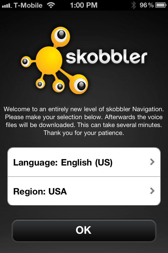
Skobbler GPS Navigation 2
GPS Navigation 2 is an unusual navigation app. It is the first app I’ve seen that employs both storage and connectivity based navigation. This hybrid approach ensures you have the app responsiveness you get from having maps on your device, along with the up-to-date data that you get from connectivity-based navigation.
 From a cost-only perspective, this application wins in this roundup as it’s the cheapest one reviewed here, and the one that would seemingly provide the best value. Ninety-nine cents gets you navigating immediately as long as you have a solid 3G/4G cellular connection.
The app’s menus are visually stunning. Navigating through its menus is easy to do, and most of the menu paths should make sense to US-based drivers. This is a point of note, as after nearly 10 years of reviewing navigation apps, I’ve noticed that PNA/navigation apps are used differently in the US than in Europe. Use cases from the continent don’t translate well to the States and vice-versa. Skobbler seems to have cracked the menu navigation nut and has pulled together an application that should work well for both major markets.
The navigation process, however, wasn’t as satisfying as the rest of the application. The navigation screens themselves are not as attractive as the rest of the app. I found them to be rather ugly in fact, a far cry in contrast to TomTom or iGo primo.
Even though the application indicated that it had a good GPS signal lock, the position of the vehicle vs. the actual position was inaccurate, off by what seemed like 30-60 feet. If you could not follow the documented route, it took the application close to 20 seconds to acknowledge that fact and recalculate its route to match the new starting point or location. The application also seemed as though it was determined to route you through its originally calculated path rather than determining a new route. The routes the application chooses seem to take the user out of the most direct route.
In addition to accuracy issues, the application also seems to suffer from a great deal of jitter and GPS inaccuracy. The screen never seems to orient itself correctly based on your current direction of travel. If and when it does, the screen turns and bounces. I’m not certain if the navigation issues I’m referring to are due to the apps use of OpenStreetMaps or other programmatic issues, but I found the whole experience to be very disappointing whatever the reason.
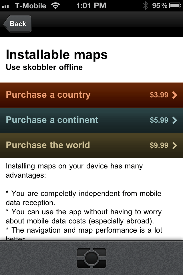
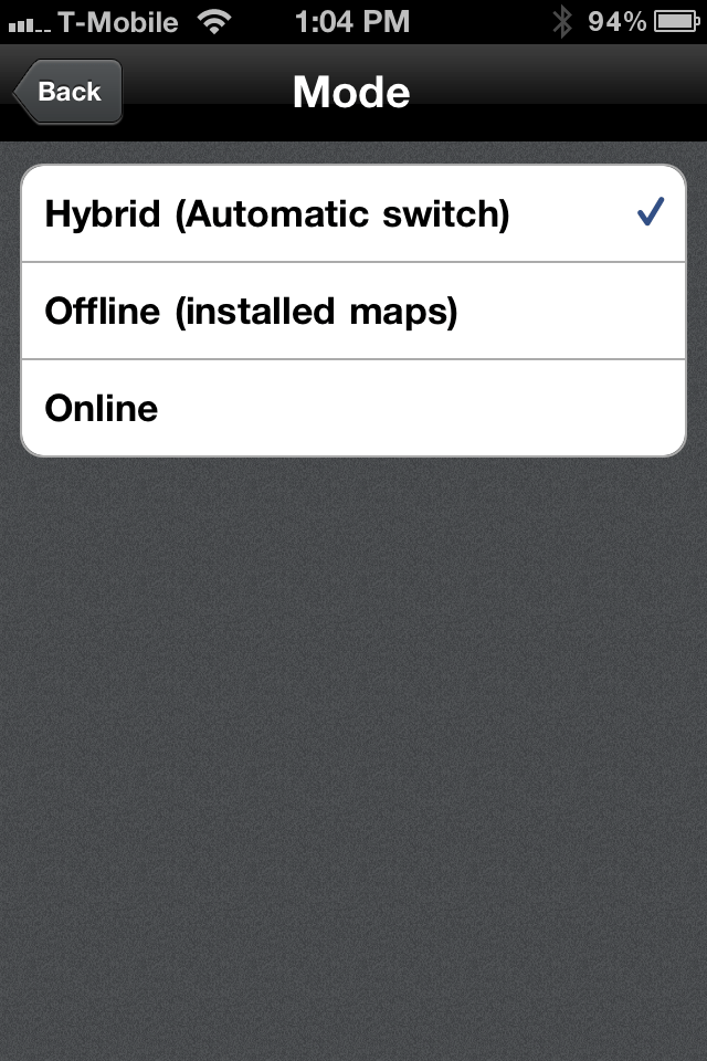
Navigation used to be online only and subscription based ($3/month, $30/year). Now navigation is either online, offline via downloadable maps, or hybrid (a bit of both). You can purchase off line maps by country for $3.99 each, continent for $5.99 each or global for $9.99.
$0.99 USD for app
$3.99 per country map as an in-app purchase, or
$5.99 per continent map as an in-app purchase, or
$9.99 for the global map as an in-app purchase
(On Demand-Storage Hybrid) iTunes – US/Can
 |
 |
 |
 |
 |
 |
 |
 |
 |
 |
|
 |
 |
 |
Garmin StreetPilot on Demand
Garmin StreetPilot on Demand is a true connectivity-based navigation app. If you don’t have a solid 3G/4G connection to your device, then this app is likely not going to be of much use to you. It does not have an offline mode like Skobbler GPS Navigation 2 does.
 I wasn’t too taken by the application’s screens or menus. They weren’t ugly or visually stunning, merely okay. However, the app was exceptionally accurate and responsive. When rerouting, the application did a stellar job of using your current location as the new starting point for your trip. This method of route recalculation may take a few moments longer to complete, but is preferable to the method used in Skobbler GPS Navigation 2.
The application’s Local Search function is powered by Google, and from a navigational perspective, is somewhat comparable to Google Maps, though it does not present the same IYP profile when presenting results. I did think that it was the best app in this roundup for local search, however. Local Search is an area where a lot of money can be made, and from a navigational perspective, Garmin has built a great interface in their app to handle it.
The item that bothered me the most, however, was the use of the “big blue car” to represent your current location. While it’s genuinely big enough for me to see, it’s a bit too oversized and I consequently found it very distracting. Other applications in this round up present your current location in a much better manner. I also found that navigational settings, such as my Home Location, were not retained correctly until after I purchased a navigation subscription.
Garmin Street Pilot on Demand is $0.99. Navigation with its on demand maps is $2.99 per month or $29.99 per year via in-app purchase. Subscriptions auto-renew until cancelled.
$0.99 USD for app
$2.99 per Month for Navigation as an in-app purchase, or
$29.99 per Year for Navigation as an in-app purchase
(On Demand) iTunes – Universal
 |
 |
 |
 |
 |
 |
 |
 |
|
 |
 |
 |
 |
 |
 |
 |
 |
Worth Mentioning
Google Maps
Google Maps is part of the standard iOS build, so there’s no way for users to download Apple’s default mapping software separately. Google Maps for iOS has changed only somewhat since its introduction as part of iOS 3.x. Its integration with Siri as part of iOS 5.x in the iPhone 4S, however, is really very nice.
Google Maps can provide you with accurate directions from A to B while showing your current geographic location on its on-demand maps. Directions delivered either via Siri voice commands or user intervention are delivered quickly and are as accurate as the maps the application pulls from. Google Maps for iOS supports both walking and car based directions. What it can’t do on the iPhone, however, is the turn by turn navigation that it does so flawlessly on in its Android counterpart.

Waze is a unique application. It got its start in the Android world, got noticed and then made the jump to iOS. Waze attempts to solve the problem of navigational map accuracy by enlisting its users to validate the maps that it provides in an on-demand fashion. In true Pac Man-like style, users gain points for application use and for “road munching,” or gobbling up dots on unvalidated roads. Waze then takes this validation data and uses it to confirm that the cartography data they have is accurate. Waze also provides you with access to navigation-centric, social networking features. Users get points for reporting accidents, speed traps, police cruiser locations, etc.

While Waze will provide you with turn by turn navigation, after the novelty of the “game” wears off and the metaphor gets to be a bit long in the tooth. And while Waze does a good job of navigating you from A to B, serious GPS navigation needs are probably better satisfied and provided by an app that takes the task a bit more seriously. The application also requires way too much interaction from the driver during use. It’s hard to recommend an app that seems to actively contradict the distracted use warning it displays when the app first starts!
Free
(On Demand) iTunes – Universal
Like TomTom for iOS, CoPilot Live traces its roots back to the days of PDA’s and PocketPC’s. The premium version’s methods of interactive, tap-and-drag route editing is truly innovative, but the more interaction you have with the device while driving, the bigger the problems with the app — especially in light of the recent driver distraction issues that have been in the news. Like TomTom and iGo primo, CoPilot Live supports lane indicators, realistic signpost info, etc., in order to make tricky turns and interchanges easier to negotiate. This is becoming a very popular feature, and one that the better apps will have as time goes on.
CoPilot Live is a storage-based navigation solution; its ALK MapSure service provides monthly, free in-app map improvements and full quarterly map updates. It also supports live traffic in a yearly subscription model as an in-app purchase. The subscription automatically renews unless and until cancelled.
At $14.99, this is one of the more affordable, storage-based navigation solutions on the market, and an overall good choice. Other apps in this roundup, however, edged it out just based on the interface and presentation of the overall solution.
$14.99 for app
Free Map Updates
(Storage) iTunes – USA, iTunes – Europe

Sygic is a storage-based navigation app that uses maps from TomTom for iOS to guide users via voice-guided GPS navigation. Sygic supports hardware-accelerated 3D rendering as well as Apple’s Retina Display. The app is also optimized for iPhone 4S, iPad 2 and the New iPad. Sygic is compatible with iOS 5 and contains support for iCloud. You can backup your favorite POIs, Settings, History, Favorites and Travel Book.
Most navigation app displays tend to be rather plain. Sygic’s screens, however, contain a great level of detail. In their attempt to make the application deliver realistic screens, the app contains perhaps too much detail, especially in metropolitan areas. The screens can be a bit on the busy side, and that can be somewhat distracting. Its other safety features, however, provide a great deal of comfort. Its road incident sharing and real-time incident notifications can help you navigate around accidents and traffic snarls. Its audio stream can also be pushed through your car’s audio system either via Bluetooth or auxiliary cable.
$29.99 for app
Free Map Updates
(Storage) iTunes – US, iTunes – Europe
Conclusion
Storage based navigation apps provide you with most, if not all, of the data you need for total navigation in your country or navigational area of choice. That said, they require a great deal, a minimum of up to 10%, of your total storage space for all of their data. On-demand based navigation apps are easier on the storage requirements, but require a reliable, high speed cellular internet connection to provide you with the data you need to complete your navigation task.
In a well-covered metropolitan area, or at least a well-traveled US Interstate corridor (and depending on your cellular carrier), having either the entire North American or US map data on my iPhone 4S isn’t an issue. In Chicago, for example, my carrier, T-Mobile, has reliable coverage, and I’ve got plenty of 4G goodness via my Sonic 4G Wireless Hotspot. On weekends or when I don’t really have it with me, however, navigation via connectivity based navigation solutions aren’t always a good idea. While EDGE on an iPhone is OK for most non-data intensive stuff (status updates on Twitter and/or Facebook, texting, calls, etc.), staying inside a 3G/4G coverage area is needed for connectivity0based navigation solutions.
At the end of the day, which app or type of app is best for you can be a coin toss. It’s going to depend on how much you like the navigation screens more than anything else really. Pick the one that seems like it would be the most visually appealing to you, and then look at how well it performs. This thing is going to be running in your car, talking to you, for probably as long as you have your iPhone. Don’t fool yourself. Great performing and accurate apps that are found to be visually unappealing won’t get used.
As a final point, if you decide to go with a connectivity-based navigation system, you’re going to need to insure that your intended route supports the level of connectivity you need, whether you’re going out of state or to a local but unfamiliar area. Having your map go out of on you due to lack of signal isn’t something that gets covered in any app’s user manual but is something that you’ll need to consider. Check your coverage area before you start out, and make sure that you’re going to have the connectivity you need. Getting lost while using a GPS app that doesn’t have the Internet connection it needs to get you unlost can really suck.

Leave a Reply